
Northland has escaped torrential rain and flooding overnight, with the state of emergency being lifted.
Rain has stopped for most of the region and there are no widespread flooding issues, said Northland Civil Defence Emergency Management group controller, Graeme MacDonald.
“Thankfully we didn’t get the major issues that we thought we were going to get from the MetService heavy rain warning,” he said on social media at 8am.
A state of emergency was declared across the region on Tuesday – a precaution because of the forecast – causing many businesses and offices to shut early.
READ MORE:
* Concerns for Māori and disabled as state of emergency declared in Northland
* Waitangi commemorations to go ahead despite state of emergency
* Auckland, Northland’s misery continues as heavy rain keeps coming
The state of emergency was lifted at 10am, as the emergency powers were no longer needed, MacDonald confirmed in a press release.
Yesterday’s emergency declaration was communicated through an emergency phone alert but Northland Civil Defence decided not to send a second alert as it lifted, to minimise any disruption to the public.
Although the emergency powers were not needed, Far North deputy mayor Kelly Stratford said declaring the state of emergency on Tuesday was the right decision at the time, given MetService’s red heavy rain warning.
“It’s not like a lockdown. It just gives us powers – should a risky situation arise – to help people.”
Iwi leader Huhana Lyndon (Ngātiwai) said she was pleased an emergency was declared in Northland, as it enabled communities to get prepared.
Local marae were opened as evacuation centres overnight, she said.
Waka Kotahi/Stuff
State Highway 1 at Brynderwyn Hill has been shut through slips since Friday, with a timeframe for reopening still unknown.
Three families in flood-prone Oakura Coast, northeast of Whangārei, decided to spend the night at their local marae rather than risk flooding, Lyndon said.
“I really appreciate families being proactive.”
Kaumatua and kuia in Whirinaki Valley, south Hokianga, were also evacuated on Tuesday but there have been no reports of other evacuations.
While the rain was not as bad as predicted, Whangārei mayor Vince Cocurullo also said the state of emergency was the best option at the time.
“It’s better to be pre-warned than the other way,” he said.
Notorious flooding spots like Kāeo had just 32mm of rain in 24 hours to 9.30am.
Cocurullo said the worst of the rain fell in the southern parts of Northland, with Marsden Point getting 81mm of rain over 24 hours.
Up to 600 homes and businesses had power cuts in the Far North on Wednesday morning, but that was down to just a handful by 1pm on Wednesday.
Denise Piper/Stuff
On Whangarei’s Rathbone St, property manager Andy Bowater installed a floodgate in front of YHPJ Chartered Accountants, with the help of Taylah Sowry, on Tuesday afternoon. The precautions turned out to not be needed, with the rain not as heavy as predicted.
Far North mayor Moko Tepania said it was great the area had come out relatively unscathed.
State highway still closed, caution required on other roads
State Highway 1 remains closed at Brynderwyn Hill, with heavy traffic told to use SH12 and SH14.
Light vehicles can detour through Mangawhai and Waipū, however, they will need to drive with caution as there is a slip Cove Rd East at Langs Beach, Cocurullo said.
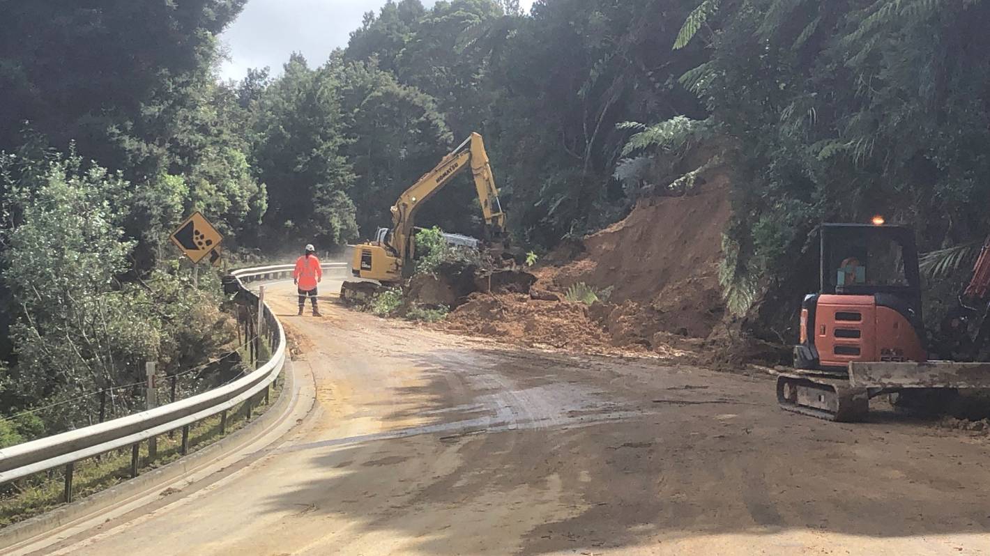
Waka Kotahi/Stuff
More slips came down on SH1 at Brynderwyn Hill on Wednesday morning. The highway remains shut.
More slips fell on the road overnight and a date for reopening was still not known, a Waka Kotahi NZ Transport Agency spokesperson said.
“Our crews and geotechnical team are now on site clearing debris, fallen trees and confirming the stability of the entire route including underslips,” she said.
“Once geotechnical investigations have been carried out, we’ll have a timeframe for re-opening.”
Hayward Rd in Maungakaramea is closed but Waipu Gorge Rd has recently reopened with a major slip and fallen tree being cleared.
Denise Piper/Stuff
A tree down on Russell Rd near Oakura on Tuesday was cleared away by crews by Tuesday evening.
A number of roads are also down to one lane but passable with caution in Whangārei district.
They are Bahama Pl (Parahaki), Brooks Rd, Cove Rd (Langs Beach), Finlayson Brook Rd, Glenmohr Rd, Matapouri Rd (Sandy Bay hill), Millbrook Rd, Russell Rd (Whangaruru), South Rd (near Waipū township) and Waipu Caves Rd.
Cocurullo urged people to report any flooding, slip or fallen trees to council – call 09-430-4200 in Whangārei.
In the Far North, Maromākū-Tōwai Rd is the only road closed by flooding, although SH1 at Mangamuka Gorge remains closed after slips in August 2022.
Caution is also required on a number of Far North local roads due to flooding or fallen trees.
They are Commerce St (Kaitāia), West Coast Rd (Mitimiti), Takou Bay Rd (Kāeo), Otatara Marae Rd (Waimā), Matawaia-Maromākū Rd, Pokapū Rd (Moerewa), Curtis Rd (Rāwene),
Hōreke Rd, Wekaweka Rd (Waimamaku).
In Kaipara, Child Rd and Valley Rd are restricted to four-wheel-drives only due to flooding, and caution is required on Taipuha Sett Rd due to flooding. Pebblebrooke Rd is down to one lane due to a slip.


