
Windy weather and rain will be rolling over the country on Tuesday, with MetService watches or warnings in almost every area of the North Island.
There are 17 weather watches or warnings in place over Aotearoa.
MetService issued a severe thunderstorm warning for much of the North Island, including Auckland, Northland, Coromandel Peninsula, Bay of Plenty and Whanganui.
“Some of these thunderstorms may be severe, producing damaging wind gusts in excess of 110kph and a few small tornadoes, and in addition for regions from Waikato and Bay of Plenty southwards localised downpours of 25 to 40mm per hour are possible,” MetService said.
READ MORE:
* Sand top-up for popular Wellington beaches a shore thing
* Mighty oak crushes classroom and kids’ dreams of a happy end to the school year
* Sound ‘like thunder’ before massive tree toppled onto commuter
The warnings are in place from 2pm to 10pm.
MetService/Supplied
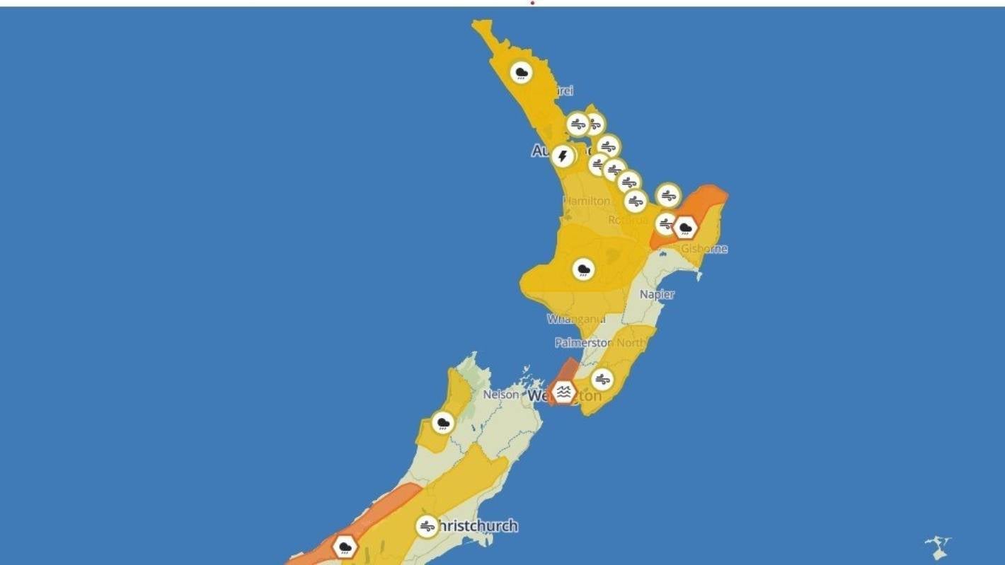
MetService weather watches issued on Tuesday morning cover most of the North Island.
It’s bad news for the East Coast too, which was hammered by flooding earlier in the year. A heavy rain warning is in place east of Ōpōtoki, as well as the Gisborne ranges and the area north of Ruatōria.
Up to 140mm of rain is expected, and MetService warned that could cause streams and rivers to rise, and driving conditions could be hazardous.
A low front is running across the country, creating the potential for heavy rain and further thunderstorms, said MetService meteorologist John Law.
Ricky Wilson/Stuff
Thunderstorms and heavy rain in Auckland last week.
Ten weather warnings and watches were in place on Monday evening that have been since upgraded, showing Tuesday could bring strong gusty wind, heavy rainfall, and large swells.
Thunderstorms are set to hit much of the North Island in the afternoon, affecting anywhere further north than New Plymouth.
In Northland, the periods of heavy rain and northerly winds would begin early on Tuesday morning, running until about midnight. Tuesday night could see severe gales with the region under a strong wind watch.
From Auckland down to the Bay of Plenty, strong wind watches are in places, with northerlies which could reach severe gales from 8pm on Tuesday.
There are possible thunderstorms and heavy rain in Auckland on Tuesday afternoon, said MetService. Gales could gust up to 100kph.
North Taranaki and parts of the central North Island will also experience periods of heavy rain, which could reach warning levels.
In Wellington, the city could have a dry Tuesday but with strong winds. There was a heavy swell warning on the east coast from Wednesday morning.
Christchurch and Dunedin are looking fine, with a few showers possible in the afternoon. Christchurch is forecast to reach 23C.
Rural Canterbury is under a heavy wind watch from the same nor’westerlies affecting much of the country.
The West Coast is likely to have thunderstorms, heavy rain, and thunderstorms are possible. The rainfall may approach a warning level, MetService said.


