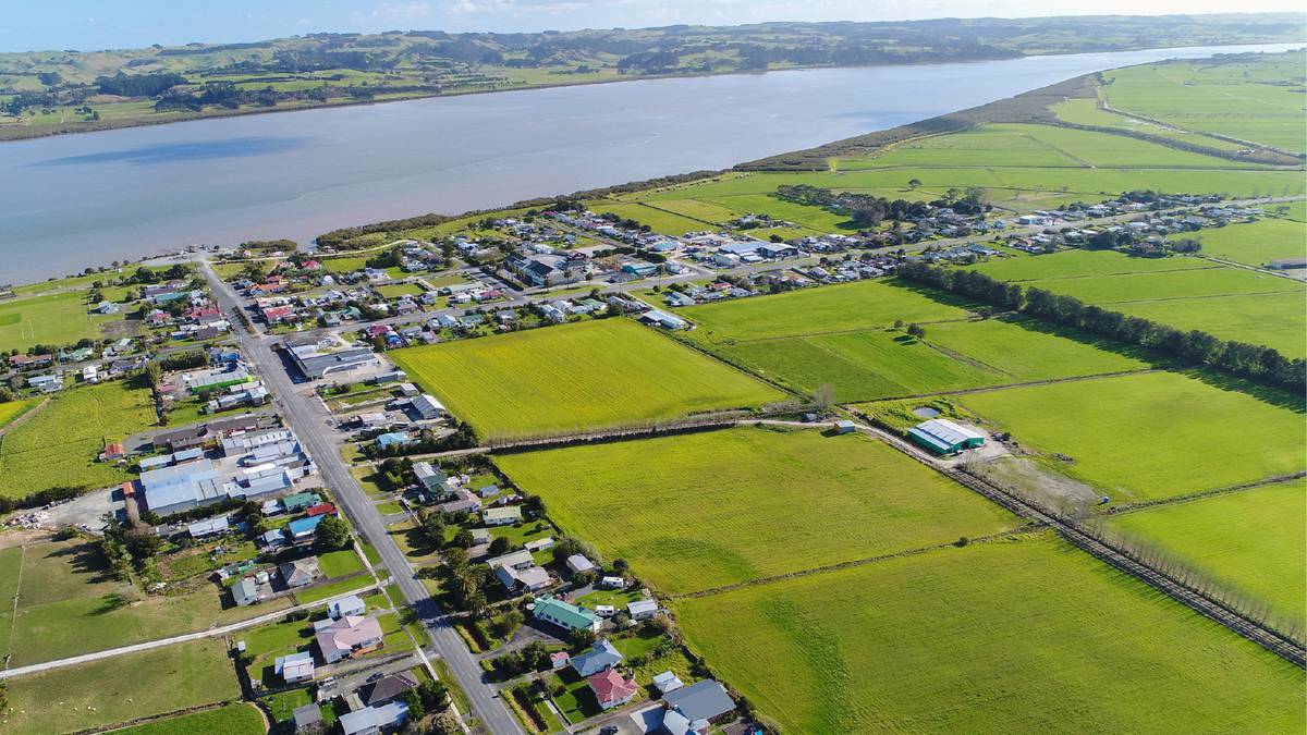
The Ruawai Flats are home to considerable agriculture and horticulture production, including a large portion of New Zealand’s kumara production. Photo / supplied
Farmers on flood plains hope to be ready if climate change projections start to come true.
An inaugural meeting of the Ruawai Adaptive Pathways Community Panel has been held with widespread interest from the community.
Kaipara District Council’s climate change advisor Katy Simon said the Ruawai panel is the first pilot group, with others to follow in the district once this group has become established.
The panel will comprise 21 people, drawn from a wide range of industries and community groups.
Ruawai is a small township about 30km south of Dargaville. The area was once a swamp and sits below sea level where the Northern Wairoa River meets the Kaipara Harbour.
The Ruawai Flats is home to 500 residents and about 186 dwellings, small businesses and considerable agriculture and horticulture production, mostly dairying and kumara growing.
The area is within the North Kaipara Agricultural Delta, part of the area that contributes to 95 percent of New Zealand’s kumara production.
“The Kaipara Harbour is the biggest estuary in the southern hemisphere, with many tributaries and rivers draining water from as far as the Hikurangi Swamp.
”There’s a huge amount of water and the area is prone to flooding, with a lot of water draining down and out as well as coming in from the harbour,” Simon said.
“A lot of the Ruawai flats are sitting on limestone beds, basically former ocean floor at or below sea level. Farmers there are used to dealing with flooding a lot.”
The Raupo Drainage District was constructed more than 100 years ago and comprises a complex system of 3.5m stop banks, flood gates and drains. The system protects about 9000ha of flat alluvial land.
“This area has a fascinating history and local people were eager to share their historic photos at a community open day held in June. More than 300 people attended,” Simon said.
“This community really appreciates the past and all the efforts that have gone into the drainage scheme, which is run by the Raupo Drainage Committee and funded through a targeted rate to help with maintenance.
“The committee does an impressive job managing the drainage scheme given the amount of work that’s needed and a historical absence of funding for major work such as floodgates or raising the stopbank levels.”
Dynamic Adaptive Pathways Planning (DAPP) is a framework used to help manage hazards, reduce risks and build resilient communities. It is being used nationally to form community plans.
Simon’s role is to guide the community through a planning process that considers possible risks in the future and forms an adaptive plan with multiple possible pathways that the community and council can follow if agreed trigger points are ever reached.
“We are not trying to scare people. We want to make sure responses are based on real changes we’re seeing on the ground. That’s why a DAPP framework works so well.
“It may be that some projected climate change events never happen, but we want the communities to be ready if they do.”
Hazards predicted for the future in the area include:
– a permanent sea level rise of 0.3m between 2045 and 2060.
– a rise in average temperatures of between 0.5 degrees Celsius and 1.5 degrees by 2040.
– an increase in the severity and frequency of ex-tropical cyclones reaching Northland.
– more heatwaves, extreme rainfall events and longer dry periods.
– an increase in ocean temperature and a change in ocean chemistry affecting marine species.
Salt water can be a threat to aquifers and water supplies.
Simon said the community panel would be tasked with finding what pathways are acceptable in the future and what the trigger points might be to set the plans in motion.
“There are a lot of implications that need to be worked through and more technical research and modelling will need to be done to help inform the panel’s decisions.”
Simon gave examples of different scenarios that might cover if flood-prone access roads needed to be raised or moved or if land use might change if conditions become untenable.
“It is possible to engineer ways around most problems, but the community may decide the costs are too high and that will be part of their decision process.”
Once the panel members have been confirmed, a site visit and tour of the area’s drainage system is planned, possibly in December or early next year.
Two facilitators will help the panel formulate the adaptive plan, which will be shared regularly with the council as it is developed.


