Cyclone Gabrielle is expected to make landfall early on Tuesday on the eastern side of Northland – but bad weather will start from Sunday, according to experts.
A heavy rain watch is in place for Coromandel, along with Northland and Auckland north of Whangaparāoa, from Sunday morning through to midnight Tuesday.
According to MetService forecaster Aidan Pyselman, while the bad weather would start late on the weekend, the cyclone wouldn’t actually make landfall until early Tuesday.
It would touch down on the eastern part of Northland, before heading down into Auckland, he said.
READ MORE:
* Cyclone Gabrielle could hammer Coromandel with up to 300mm of rain in 24 hours
* Coromandel extends state of emergency as Cyclone Gabrielle approaches
* Tropical Cyclone Gabrielle set to barrel toward New Zealand
The cyclone was expected to then roll down the country through Tuesday and into Wednesday, heading east, Pyselman said.
“It’ll then drop down into Hawke’s Bay.”
It was still a few days out and models might change, he said.
According to MetService, between 200-300mm of rain could fall in Coromandel in the 24 hours from Monday morning to Tuesday morning.
MetService/Supplied
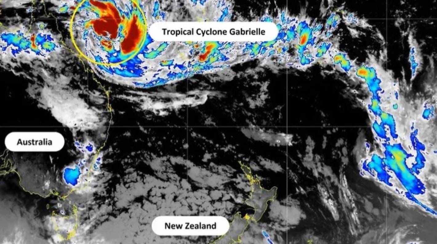
Tropical Cyclone Gabrielle is expected to hit the eastern side of Northland on Tuesday.
Auckland and Northland could see between 150-200mm of rain in the same period.
A strong wind watch is also in force for Northland and Auckland north of Whangaparāoa from 6am Sunday to midnight Tuesday.
Auckland south of Whangaparāoa and Coromandel Peninsula have a strong wind watch from 6am Monday to midnight Tuesday.
“If the cyclone continues on its current path towards the north of Aotearoa New Zealand, we can expect this to be an extreme weather event with widespread damage,” MetService’s head of weather communication Lisa Murray said.
Abigail Dougherty/Stuff
Multiple roads in Auckland’s west were blocked by landslides following the January 27 floods.
“Those areas that are already vulnerable following last week’s weather are expected to see more rain, strong wind, heavy swells and coastal inundation which will exacerbate the situation.”
On Thursday night, Auckland mayor Wayne Brown extended the region’s state of emergency for another week ahead of Gabrielle making land.
The state of emergency has been in place since January 27, when torrential rain caused devastating flooding, killing four people.
“My decision reflects the seriousness of the current and potential situation and our response,” Brown said on Thursday afternoon.
“After what Aucklanders have experienced since Friday 27 January, and with our region waterlogged, it will be a very serious situation if the current weather forecasts eventuate.”
The storm was classed as category 2 on Thursday, but was expected to reach category 3 by Friday morning.
According to MetService, a category 2 tropical cyclone has an average wind speed of between 89kph and 117kph.
A category 3 tropical cyclone, with the upgraded “severe” designation, has an average wind speed of between 119kph and 157kph.
People have been urged to get three days of supplies together in case they are stuck at home due to flooding and slips.
Twenty-one evacuation centres will open in Auckland in case of mass displacement.