Cyclone Gabrielle is expected to become a category 2 storm on Thursday morning and then intensify to category 3 later in the day.
The storm is predicted to bring more severe weather to the upper North Island on Sunday, a fortnight after devastating rain hammered Auckland, bringing widespread flooding.
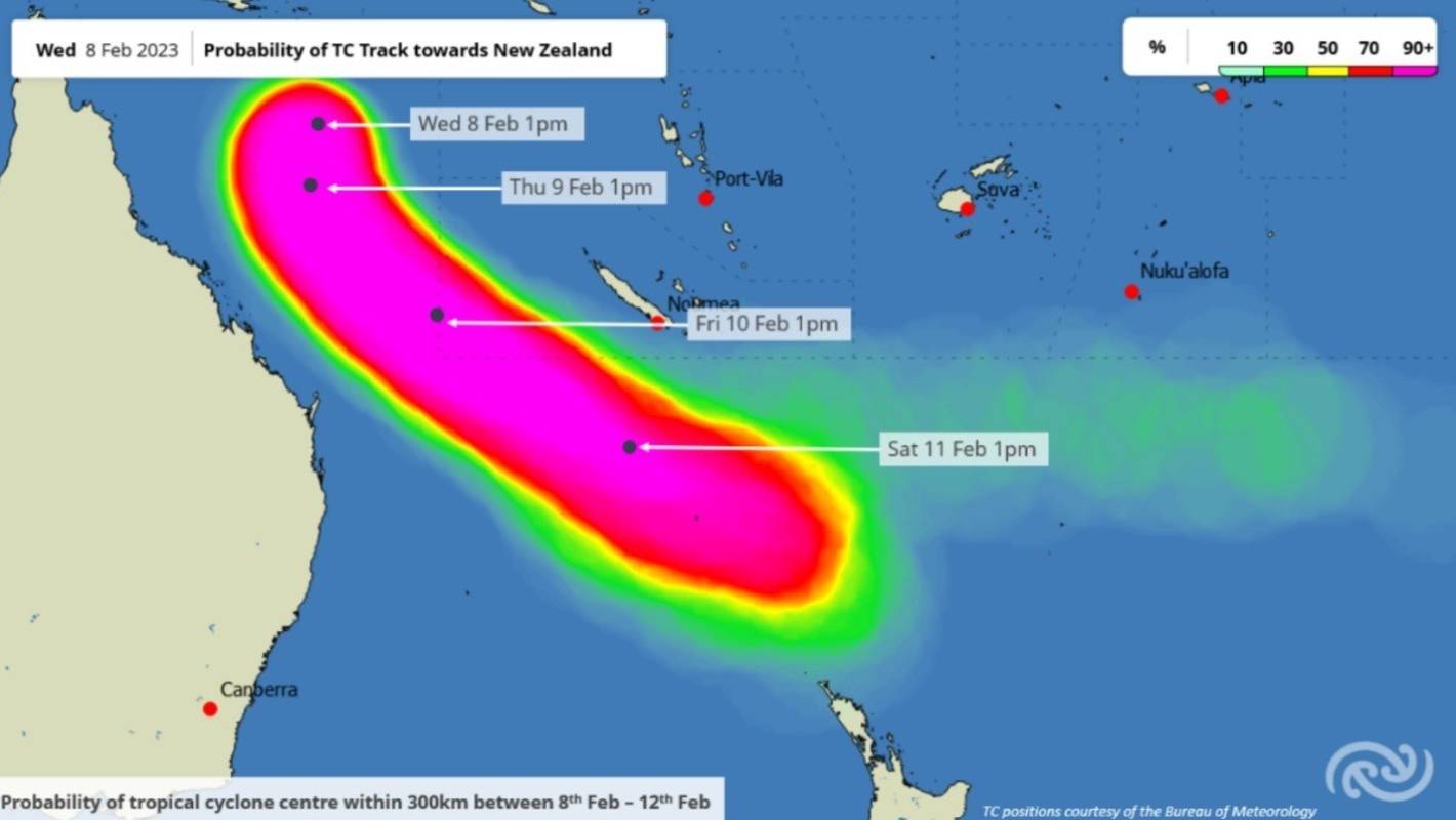
MetService/Supplied
New Zealand is in the firing line for another lot of severe weather, with Tropical Cyclone Gabrielle making its way towards the country.
The Australian Bureau of Meteorology is predicting Cyclone Gabrielle to significantly strengthen over the course of Thursday, turning southeast at some point towards Aotearoa.
On Wednesday, the bureau named the system Tropical Cyclone Gabrielle after it officially formed out of a low pressure system.
READ MORE:
* Tropical Cyclone Gabrielle set to barrel toward New Zealand
* Potential cyclone on track to hit North Island will form a day sooner
* Weekend brings rain, cold southerly gales, even some snow
According to NZ’s MetService, a category 2 tropical cyclone has a mean wind speed of between 89kph and 117kph.
A category 3 tropical cyclone, with the upgraded “severe” designation, has a mean wind speed between 119kph and 157kph.
Currently, Gabrielle is sitting 650km off the coast of Queensland in the Coral Sea.
It is not expected to make landfall in Australia, but it is forecast to pass over Norfolk Island on Saturday. So far, no cyclone warning has been issued for Norfolk Island.
Then, the storm is forecast to turn southeast towards Aotearoa and move down the Coral and Tasman seas over the following few days, when it will strengthen.
Weather forecasters are predicting heavy rain for Northland, Auckland, the Coromandel and the East Coast on Monday.
There remains uncertainty around the exact path of the cyclone as it approaches New Zealand, and how things play out will be determined in the coming days.
But, forecasters are expecting severe wind and rain for the upper North Island.
MetService has reminded the public that heavy rain could see rivers swell, surface flooding and slips.
Niwa meteorologist Chris Brandolino said, by Tuesday next week, some places could see well over 100mm of new rainfall.
The rain, he said, could exacerbate conditions in the already wet upper North Island and could lead to slips.
Ricky Wilson/Stuff
Auckland and other parts of the upper North Island were hit by severe flooding only last Friday.
“We could be looking at a month’s worth of rain over some areas in a day or something like that … that’s a flooding risk.”
But if the cyclone travelled further west or east, much of the rain could end up in the sea.
“For people living in the upper North Island … from Sunday night through middle Tuesday, I’d keep a sharp eye on the forecast.”
As the effects of the storm were still a few days out, MetService said it couldn’t predict exactly how much wind or rain it would bring or where it would go with a high level of confidence.