A cyclone is expected to form off the coast of Queensland today and then begin to barrel towards New Zealand tomorrow.
The storm is predicted to bring more severe weather to the upper North Island, a fortnight after devastating rain hammered Auckland, bringing widespread flooding.
Niwa meteorologist Chris Brandolino said the effects of the storm depended on where it tracked when it was forecast to hit late on Sunday.
However, he was getting closer to being able to predict what would happen.
READ MORE:
* Watch live: Officials due to give update on Auckland flood recovery
* Auckland flood storm might have been a one-in-250-year event, Suncorp says
* Rain pushes Auckland construction firm with more than 100 employees into liquidation
“By Tuesday some places could see well over 100mm of new rainfall,” he said.
The weather system is expected to lose strength while over the sea and lose its status as a cyclone.
Brandolino said if the ex-cyclone then tracked down the west coast of Northland and west of State Highway 1 in Auckland, that could bring storm surges from onshore winds to Northland, Auckland and Coromandel.
The rain, he said, could exacerbate the already wet upper North Island and could lead to slips.
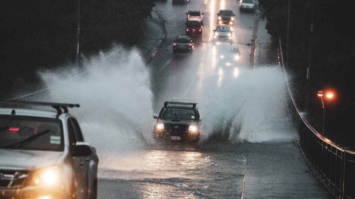
Stuff
A car drives over a flooded bridge in Auckland.
“We could be looking at a month’s worth of rain over some areas in a day or something like that … that’s a flooding risk.”
But if the cyclone travelled further west or east, much of the rain could end up in the sea.
“For people living in the upper North Island … from Sunday night through middle Tuesday, I’d keep a sharp eye on the forecast.”
As the effects of the storm were still a few days out, MetService said it couldn’t predict exactly how much wind or rain it would bring or where it would go with a high level of confidence.
However, it said the cyclone was “likely to be impactful”.
There was a 40% chance, or moderate confidence, of heavy rain on Monday for Northland, Auckland and the Coromandel, MetService said.
IMA
The low is currently in the Coral Sea, between the Solomon Islands and Queensland.
“Easterly winds are likely to pick up about northern parts of the North Island during the weekend and there is low confidence of both warning amounts of rain and severe gales for Northland.”
Large waves were likely to hit northern and eastern coastlines from Northland down to Gisborne on Sunday and Monday, the forecaster said.
There was low confidence, or 20% chance, of warning amounts of rain further south, for Waikato, Bay of Plenty and Hawke’s Bay.
The tropical depression, named 14U, remained over the Coral Sea moving west on Wednesday.
It would turn into a tropical cyclone later on Wednesday, MetService predicted.
It would then receive its name from the Australian Bureau of Meterology.
David White/Stuff
Sal Rose Italian restaurant in Mt Albert was flooded when torrential rain hit Auckland last Friday.
The system was expected to turn southeast towards New Zealand on Thursday and could reach severe category 3 or above while still over open waters in the Coral Sea.
MetService was predicting the cyclone would continue barrelling southeast towards New Zealand on Friday and Saturday before losing some of its “tropical characteristics” on Sunday.
MetService meteorologist Mmathapelo Makgabutlane said the cooler water would cause the storm to lose some of its energy and its cyclone designation before it reached Aotearoa.
But Makgabutlane said that only affected its meteorological classification and not what effects it would have for Kiwis in the upper North island.
“It’s highly dependent on how it tracks over the next few days,” she said.
The storm that had hit Auckland and the upper North Island the week before last causing flooding wasn’t a tropical cyclone, for example.