
Heavy rain has closed several roads in Northland, and MetService is warning there are still ominous levels of rain expected across the country.
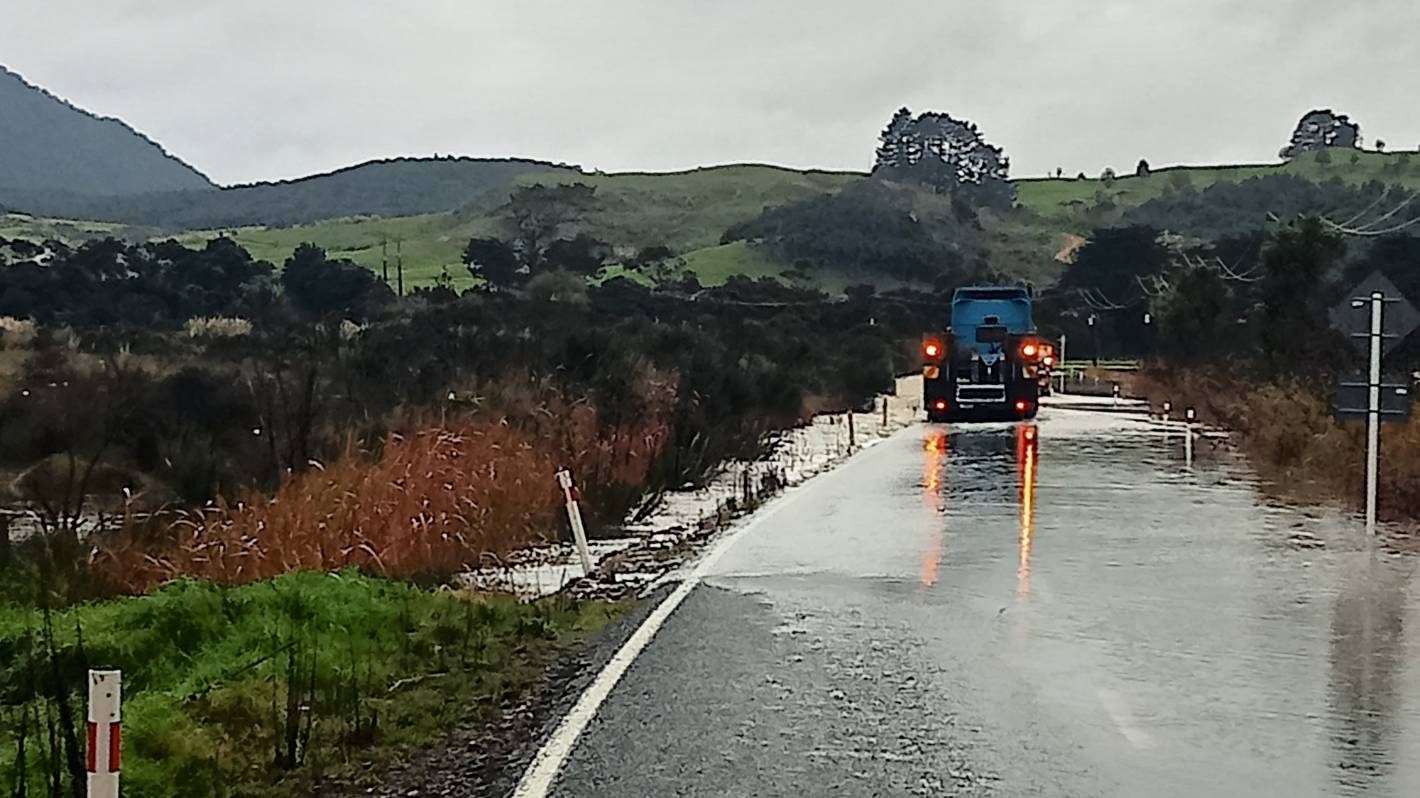
Three roads in the Far North are closed due to flooding, with more than 90mm of rain falling in some areas over the last 24 hours.
Taumata Rd in Taipā and Whangape Rd in Herekino remain closed but Kaitāia-Awaroa Rd should be passable to four-wheel-drives once the water recedes, Far North District Council said in a 10am update.
MetService has extended its orange heavy rain warnings, with more downpours in store for Northland, Waitomo, Tongariro, Taranaki, Wellington, Marlborough, Nelson and Tasman.
READ MORE:
* Weather front expected to bring weekend ‘change of scene’ with warmer temperatures and rain
* Weather: Risk of thunderstorms as front moves to the east, showery flow taking its place
* ‘No one will escape’ weekend rain; chill southerly to sweep north bringing snow to higher hills
In Northland, a further 80mm to 130mm could fall up to 9am Friday, with a possibility of the warning being extended again.
MetService said streams and rivers could rise quickly and cause slips with the amount of rainfall expected in the area.
Waitomo and Tongariro National Park are in the firing line for heavy rain until about 9pm on Thursday, with 40mm to 80mm expected on top of what has already fallen.
Horowhenua to Wellington, including the Tararua Range, is expected to get heavy rain until midnight Thursday.
But three areas could get so much rain they could be upgraded to a red heavy rain warning – MetService’s strongest warning – later on Thursday.
Lucy Waru/Supplied
Flooding has closed Kaitaia-Awaroa Rd near Rangikohu Rd on Thursday morning.
They are Taranaki, Tasman west of Motueka, and Nelson and the rest of Tasman.
Taranaki, from north of Opunake to Whangamomona, could get up to 120mm of rain up to 9am Friday, with 200-300mm expected about the mountain.
Tasman, from Motueka westwards, is expected to be hit by rain for 45 hours from 3am Friday to midnight Saturday night.
About 350mm to 450mm of rain is expected about the ranges and lesser amounts near the coast.
Marlborough, about and north of the Awatere Valley, plus Nelson and Tasman, south and east of Motueka, can expect heavy rain up to midday Saturday.
Up to 250-350mm expected about the ranges and the Rai Valley, and 120mm to 170mm elsewhere.
Heavy rain watches are also in place for western parts of Auckland and Waikato, Taumarunui, South Taranaki, Taihape (except Tongariro National Park) and northern Whanganui.
All these areas can expect periods of heavy rain until 9pm Thursday.
Buller is also under a heavy rain watch from midday Friday to midday Sunday, but MetService said this could be upgraded to a warning.
“Some areas might be added to warnings and watches, so we advise people to continue to stay updated.”
It would be warm for much of the rest of the week, MetService meteorologist Mmathapelo Makgabutlane said.
“It will be another warm day [Thursday] with tropical and humid kind of conditions.
“We are looking at maximum temperature between 18 and 22C for the day, while for overnight, temperatures are likely to be mid to high-teens.
“The warmest areas would be Northland where temperature is expected to be 17-18C.
“For most places, temperatures are well warmer than average in the month of May.
“For central North Island and Eastern North Island, temperatures are 8C warmer than usual for this time of the year.”


