
A tropical cyclone is expected to barrel towards New Zealand on Thursday.
The storm is predicted to bring more severe weather to the upper North Island, a fortnight after devastating rain hammered Auckland, bringing widespread flooding.
MetService said it had intensified on Wednesday and had been named Tropical Cyclone Gabrielle by Australia’s Bureau of Meteorology.
Around 1pm the cyclone was located more than 700km northeast of the coast of Queensland.
READ MORE:
* Watch live: Officials due to give update on Auckland flood recovery
* Auckland flood storm might have been a one-in-250-year event, Suncorp says
* Rain pushes Auckland construction firm with more than 100 employees into liquidation
It’s expected to track southwest remaining over water, before re-curving towards the southeast on Thursday, putting it on a likely path towards New Zealand.
MetService was predicting the cyclone would continue barrelling southeast towards New Zealand on Friday and Saturday before losing some of its “tropical characteristics” on Sunday.
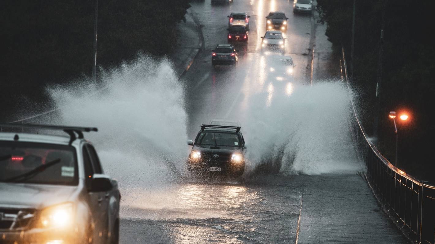
Stuff
A car drives over a flooded bridge in Auckland.
There remains uncertainty around the exact path of the cyclone as it approaches New Zealand, and how things play out will be determined by what happens in the coming days.
Niwa meteorologist Chris Brandolino said by Tuesday some places could see well over 100mm of new rainfall.
The rain, he said, could exacerbate conditions in the already wet upper North Island and could lead to slips.
“We could be looking at a month’s worth of rain over some areas in a day or something like that … that’s a flooding risk.”
But if the cyclone travelled further west or east, much of the rain could end up in the sea.
MetService/Supplied
Tropical Cyclone Gabrielle is making its way towards the country.
“For people living in the upper North Island … from Sunday night through middle Tuesday, I’d keep a sharp eye on the forecast.”
As the effects of the storm were still a few days out, MetService said it couldn’t predict exactly how much wind or rain it would bring or where it would go with a high level of confidence.
However, it said the cyclone was “likely to be impactful”.
IMA
The low is currently in the Coral Sea, between the Solomon Islands and Queensland.
There was a 40% chance of heavy rain on Monday for Northland, Auckland and the Coromandel, MetService said.
“Easterly winds are likely to pick up about northern parts of the North Island during the weekend and there is low confidence of both warning amounts of rain and severe gales for Northland.”
Large waves were likely to hit northern and eastern coastlines from Northland down to Gisborne on Sunday and Monday, the forecaster said.
There was a 20% chance that the amount of rain further south – in Waikato, Bay of Plenty and Hawke’s Bay – would justify a warning.
David White/Stuff
Sal Rose Italian restaurant in Mt Albert was flooded when torrential rain hit Auckland last Friday.
MetService meteorologist Mmathapelo Makgabutlane said the cooler water would cause the storm to lose some of its energy and its cyclone designation before it reached Aotearoa.
But Makgabutlane said that only affected its meteorological classification and not what effects it would have for Kiwis in the upper North island.
“It’s highly dependent on how it tracks over the next few days,” she said.
The storm that had hit Auckland and the upper North Island the week before last causing flooding wasn’t a tropical cyclone, for example.


