
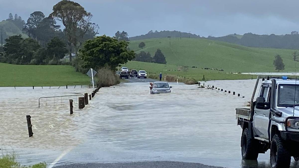
The roads have been treacherous during Northland’s three heavy rain events this month – the wettest November on record.
Three heavy rain events this month have seen Northland record its wettest November on record, with more than five times the monthly average falling.
MetService issued heavy rain watches for Northland in November, and with two days to go, it’s already the wettest November in Whangārei since records began there in 1943.
And each time the heavy rain watch was issued, down came a deluge, flooding paddocks and roadways, leaving the region sodden and rendering driving dangerous.
MetService meteorologist Dan Corrigan said Whangārei Airport had already recorded 360.3mm of rain, well ahead of the previous November record of 257.6mm in 2000.
With the average November monthly rainfall for the airport at 71.5mm, it’s already more than five times that average. Corrigan said showers between now and the end of the month will add a few more millimetres, but there’ll be no heavy downpours in Northland.
/cloudfront-ap-southeast-2.images.arcpublishing.com/nzme/MX5P7BLIUFGVFDWT37P4XJJE5I.JPG)
‘’That’s quite a bit more than normal for November in Northland, and there’s still a couple of days left, but you won’t get much more.’’
Corrigan said a series of low-pressure systems had brought sub-tropical conditions that made heavy rain much more likely this month.
‘’To have more than five times your normal November rainfall is a huge amount, but all of your heavy rain for November has now passed,” he said.
‘’You’ve had a lot of rain bands coming down that have brought a lot of moisture from the tropics and a fair bit of thunderstorm activity, too, and with those have come unstable air moisture. It’s been a really warm month, and when you have warmer temperatures from the ground like that combining with a colder upper atmosphere, that creates the perfect conditions that have been conducive to these bouts of heavy rainfall.’’
Furthermore, as climate change progresses, Northland will see an increasing frequency of abnormal warm temperatures, with high humidity and heavy rainfall becoming more common.
Niwa data shows it was New Zealand’s wettest overall and fourth-warmest July on record, with five significant weather events between July 11 and 31 giving the nation a good soaking.
/cloudfront-ap-southeast-2.images.arcpublishing.com/nzme/CAGZDCGYPRFFJLHCJQU3LB2UNE.JPG)
Climate change is here, and Niwa climate scientist Nava Fedaeff said Northland was already experiencing climate change.
“It’s not necessarily something off in the future. We’re already living in it,” she said.
New Zealand recorded its warmest-ever winter in 2020 – a record that was promptly broken in 2021.
Fedaeff expected the warming trend would continue, though that didn’t mean Northlanders would never again experience a cold winter.
Predicting future rainfall was more complicated. Higher temperatures meant the air was able to hold more moisture, which meant more rain.
However, in Northland’s case, even if total rainfall remained roughly the same, it was likely to be distributed unevenly throughout the year, with more flooding in winter and long dry spells in summer.
That “new normal” would make planning and water management difficult for the region’s vital primary sector.


