
Get ready to batten down the hatches.
That’s the message the Thames-Coromandel District Council had for its residents ahead of an expected 36-hour severe weather event starting from about 3am on Sunday.
From Saturday night, showers and wind would progressively intensify before settling in, the council said in a statement on Saturday evening.
Some 200mm of rain was expected to fall across the entire Coromandel district, with gale force easterly winds gusting up to 100kmh.
READ MORE:
* Whangamatā locals fear ‘big trouble’ if second SH25 under-slip gives way
* Road falls away on SH25 in ‘another blow’ for Coromandel Peninsula
* Coromandel ‘totally storm fatigued’, but more heavy rain expected
A short reprieve was forecast for Tuesday before stormy weather returned on Wednesday.
“Keep yourself safe,” said Thames-Coromandel mayor Len Salt, who added the district was taking the warnings seriously and asking people to pay attention to the conditions.
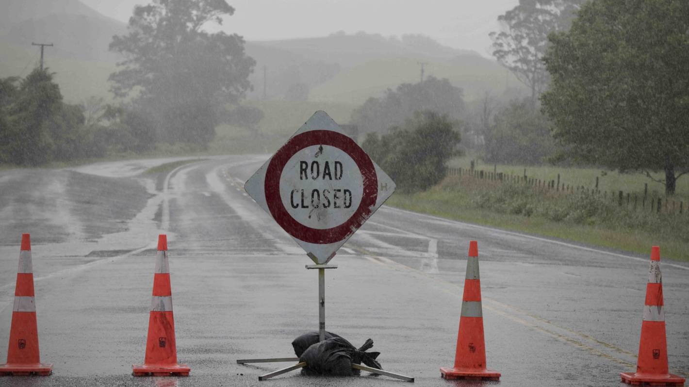
The council was expecting there to be flooding in some areas and therefore road closures.
Kelly Hodel/Stuff
Roads are expected to be closed from flooding in the Coromandel between Sunday and mid next week.
Salt said the district’s roads were still vulnerable from a number of significant weather events, including Cyclone Gabrielle, that battered it between January and March.
Salt urged residents to read Civil Defence warnings carefully and avoid travel in the district if at all possible.
“We’re always cautious about weather,” Salt said when asked how residents were faring.
The peninsula was vulnerable, he said, and each year it was typically hit by between five and six major weather events that compromised roads and caused localised flooding which in turn impacted people’s ability to travel.
But people who travelled to the peninsula were by and large aware of the potential hazards, and its residents were “resilient”, Salt said.
After several significant weather events over summer, the district’s drains and culverts had been cleared, and contingency planning had been under way in case communities were cut off again, Salt said.
“We are extraordinarily well-prepared, but at the same time we ask people be aware of the conditions and take it easy.”
Between Saturday night and Thursday up to 750mm of accumulated rainfall could strike the district, Salt said, but ultimately residents would not know their fate until it hit.
Christel Yardley/Stuff
Cyclone Gabrielle hammered the Coromandel in March. Pictured, damaged marques are seen torn in the wind in Whangamatā after Cyclone Gabrielle.
The amount of rain that would fall would depend on the speed the front was travelling and whether it had a chance to build and accumulate more rainfall over a longer period, causing more damage.
In any case, the district did not have the same level of low-lying intense housing as Auckland which caused some of its areas to be particularly vulnerable, he said.
“We take each situation as it comes.”
Civil Defence controller Garry Towler said residents should prepare and make plans if slips, falling trees, flooding, road closures and power outages impacted and isolated communities.
“Although we have had a few good weeks to dry out and get major repairs done across the roading network, the entire Coromandel Peninsula is still very fragile, and we are expecting further slips and flooding this week – some could be significant,” Towler said.
Mark Taylor/Stuff
Thames-Coromandel mayor Len Salt has asked residents to stay indoors.
The council will post regular updates on its Facebook page and Waka Kotahi and MetService will also have rolling information for residents.
Other areas under a heavy rain watch included Northland from Saturday night through to 1am on Monday; Auckland from 3am Sunday to 5am Monday; and Bay of Plenty west of Kawerau from 6pm Sunday to 9am Tuesday, according to MetService.
Strong wind watches were also in place for Auckland and Northland regions.


