
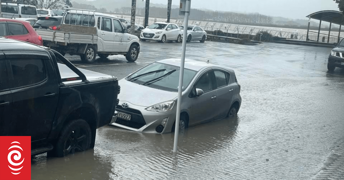

Rain and high tide combined to cause surface flooding in Dargaville township.
Photo: Supplied
Flooding caused by heavy rain has closed State Highway 1 near Cape Rēinga, NZTA said.
The closure was just north of Waitiki Landing, at the turnoff to Te Hāpua, New Zealand’s northernmost settlement.
Te Hāpua was still accessible but NZTA was warning motorists there were no alternative routes to Te Paki or to the cape.
Northland Regional Council rainfall data shows the heaviest falls in the Kaitāia and Doubtless Bay areas, with the highest rate – 25mm of rain in an hour – recorded at Pukenui, 50km north of Kaitāia, between 11am and noon on Tuesday.
Heavy rain was also falling in Whangārei and in Dargaville, where residents were reporting significant surface flooding.

Some Dargaville business owners have sandbagged their premises ahead of the next high tide.
Photo: Supplied
Northland Civil Defence spokesperson Zach Woods said Dargaville was one of the areas hardest hit by Tuesday’s wild weather, with a high tide and the heavy rain combining to cause surface flooding in the town centre.
He urged Dargaville residents to be alert to further flooding, especially around the next high tide at 1.30am on Wednesday morning.
Updates could be found on the Kaipara District Council’s Facebook page, he said.
Some businesses in the town centre had sandbagged their premises as a precaution ahead of the next tide.
Woods said the heaviest downpours so far, up to 25 millimetres of rain per hour, had been recorded in Kaitāia, Doubtless Bay and Whangārei.

Dargaville motorists are being warned to be alert for flooding.
Photo: Supplied
Serious rain had yet to hit the Bay of Islands.
MetService issued a heavy rain watch and a severe thunderstorm watch for all areas north of Whangārei until midnight.
The forecaster said thunderstorms and localised downpours were possible, especially in northern and western parts of the region.
Meanwhile, NZTA continued to urge motorists to take extra care at four trouble spots on Northland’s state highways.
The roading agency said flooding was possible on State Highway 1 at Rangiahua, west of Ōkaihau, and at Whakapara, north of Whangārei, as well as on State Highway 10 at Kāeo.
More slips were possible on State Highway 1 at Mangamuka Gorge, south of Kaitāia, which was still down to one lane after Sunday’s big slip closed the road for more than 24 hours.
Temporary road surfaces on State Highway 1 at Whakapara and Akerama, where major road rebuilding projects were underway north of Whangārei, could also be affected by heavy rain.
NZTA warned that large potholes could form anywhere and floodwaters could hide branches or other hazards.
Flooding just 30cm deep could be enough to sweep away vehicles, the agency said.
Sign up for Ngā Pitopito Kōrero, a daily newsletter curated by our editors and delivered straight to your inbox every weekday.


