
Severe winds of up to 120kph are expected in Auckland from Tuesday afternoon, with MetService warning they could cause widespread damage, road closures and power outages.
The centre of Cyclone Gabrielle is currently over the sea to the north of the Bay of Plenty. It is continuing to travel southeast. Heavy rain will keep pummelling eastern parts of the North Island, with strong winds affecting the North Island and the top of the South Island too.
Kiwis are likely to continue experiencing the wild weather from the cyclone until Friday.
Auckland is expected to get a reprieve from rain, but a red severe gale warning is in force until midnight on Tuesday.
READ MORE:
* Great Barrier Island ‘in for hard night’ as Cyclone Gabrielle tracks closer
* Red weather warnings spread as Cyclone Gabrielle hits Aotearoa
* Red weather warnings to ‘blanket’ most of the North Island over the coming days
MetService meteorologist Alwyn Bakker said the worst of the wind would hit the city in the afternoon or evening. The severity of the wind would differ throughout the region, Bakker said.
Places which had been sheltered in recent days would be hit by the strong winds as Cyclone Gabrielle moved and changed the wind direction to southwesterly.
METSERVICE
Latest MetService Severe Weather forecast, issued Monday February 13.
In the wind warning, MetService said widespread damage was expected, especially to trees and powerlines. MetService warned roofs could be lifted off buildings.
“Transport and power networks are likely to be significantly impacted, with road closures and power outages,” it said.
“Conditions will be hazardous for motorists and there is a danger to life from flying debris and falling trees or branches.”
Elsewhere, rain warnings remained in place for Western Northland, Mount Taranaki, Gisborne, Wairarapa, Eastern Marlborough and North Canterbury.
Strong wind warnings are more widespread and cover all of Northland, Taranaki, Gisborne, and the lower North Island south of Palmerston North.
A wind warning is also in place for all of Nelson and Marlborough.
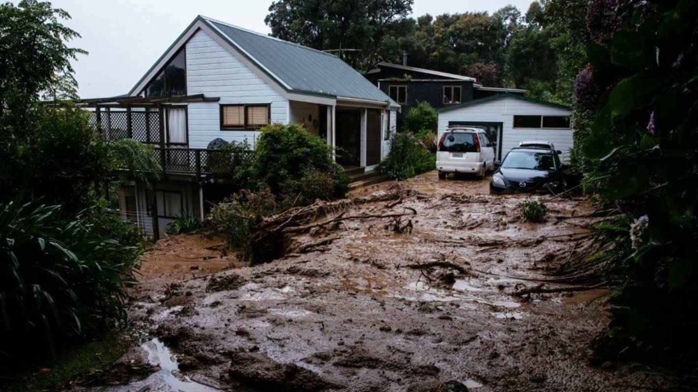
Abigail Dougherty/Stuff
Muriwai, in West Auckland was pummelled by Cyclone Gabrielle on Monday night, causing slips and significant damage.
Large waves, storm surges and coastal inundation are affecting exposed parts of the North Island’s eastern coast.
The Coromandel is due to receive a further 20 to 30mm of rain about the ranges on top of what has already fallen, with lesser amounts expected in the coastal areas.
Meanwhile, severe southeasterly gales gusting between 120 to 130kph in exposed places are expected to cause significant damage in the region.
Winds are expected to turn to a severe west to southwest gale this afternoon with gusts reaching 120kph north of Tairua Harbour.
There are widespread road closures and power outages across much of the North Island.
Tane Bradley/Waikato Times
State Highway 2 amongst the flooded Paeroa township.
Severe gales were also expected to cause widespread damage in Northland on Tuesday with 120kph southwesterly gusts likely to down power lines, uproot trees and possibly lift roofs.
Coupled with the powerful gusts, the region is under a heavy rain warning from 7am until midday on Tuesday with a further 50 to 90 mm of rainfall expected.
Heavy rain had eased in the Gisborne region on Tuesday morning, however, another period of heavy rain is forecast to bring 50 to 80mm of rain this afternoon and evening.
Following heavy rain overnight, further rain is expected to cause rivers and streams to rise rapidly while surface flooding and slips are possible.
Further south, Hawke’s Bay can expect a further 50 to 100mm of rain in the ranges south of the Napier to Taupō road and about the eastern hills south of Napier.
Rainfall is expected to reach peak intensities of 10 to 20mm an hour, but 25 to 40mm an hour is possible in thunderstorms.
Southeast winds are expected to blast Taranaki from 7am until 9pm on Tuesday.
Forecast to turn to a severe southerly gale on Tuesday morning with gusts reaching 120kph, MetService warns damaging gusts could get up to 130 to 140kph in the morning.
Taranaki is expected to accumulate 100 to 150mm of rainfall which may cause streams and rivers to rise rapidly.


