A new database pulling in events from as far back as the 1800s is allowing scientists to model where tsunamis would most likely hit New Zealand.
A collaboration between GNS Science and Toka Tū Ake EQC, the New Zealand Tsunami Database features more than 900 records, displaying them on an interactive map that allows scientists – and the public – to zoom in on areas and find out about previous tsunami.
While there have been no tsunami that caused major damage in the past decade in New Zealand, there have been scares and experts warn history showed big tsunami could occur.
Rosa Woods/Stuff
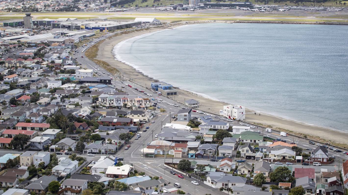
Lyall Bay in Wellington would be badly affected by a large tsunami. (File photo)
GNS earthquake geologist Kate Clark said the new database allowed modellers to look at historical records and see how modern tsunami could affect New Zealand.
READ MORE:
* Ocean floor view to give clearer picture of subduction zone earthquakes
* Scientists set to discover secrets of past earthquakes by digging down deep at Cape Palliser
* The science of tsunamis and what parts of New Zealand are most at risk
The map showed most of the country’s coastline had been impacted by tsunami – there was nowhere that had been completely untouched, Clark said.
LAWRENCE SMITH/Stuff
Residents across the east coast of Northland evacuated to higher ground following a tsunami alert in 2021.
The Chatham Islands, Banks Peninsula and the eastern coast of the North Island (running from Gisborne, up past Auckland) had historically been hit more often by tsunamis, according to the data.
They were also vulnerable to future tsunami.
The database showed there had even been a few tsunami in Taupō after earthquakes caused landslides into the lake.
Wellington has also had more than its fair share of tsunami, with a few particularly bad ones in the 1800s, according to the data. Records show that of the region, the harbour around Oriental Bay had been the most affected in the past. Modelling suggests that a modern-day tsunami could injure or kill thousands in the capital.
Toka Tū Ake risk reduction and resilience manager Sarah-Jayne McCurrach said the database would be a key tool for decision-making and helping to steer the country’s hazard risk management and emergency preparedness.
Joseph Johnson/Stuff
The database is a key tool for helping steer New Zealand’s emergency preparedness, researchers say. (File photo)
“While we might not have experienced significant or damaging tsunami events like other countries have in recent years, this database shows we have experienced very large tsunamis in the past,” she said.
“That’s why it is important to know as much as we can about what we could face in New Zealand.”
Over the past decade the country had significantly expanded its capabilities to monitor and detect tsunamis, she said.
“It can be scary to think about a tsunami happening on our shores, but it’s important to be prepared.”