- A heavy rain warning has been issued for Northland, with a strong wind watch as well
- Areas that were already flooded likely to be made worse, says MetService
- Fourteen-hour heavy rain watches have been issued for Auckland, Coromandel Peninsula, Bay of Plenty, Gisborne and Hawke’s Bay, north of Mohaka
The top of the country is set to be soaked by a second winter weather system in a week, with heavy rain and gales forecast again.
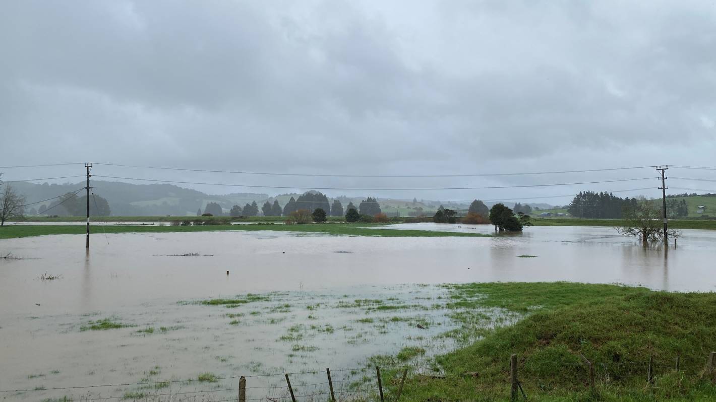
On Tuesday, Northland was hit hard as the country got walloped by a storm which closed highways, flooded paddocks and brought snow to some parts of the South Island.
MetService has issued a heavy rain warning for Northland, telling residents to expect between 50mm and 70mm between noon on Thursday and 3am Friday.
READ MORE:
* Storm brings ‘wall to wall’ snow to southern skifields
* By the numbers: The storm that lashed the whole country
* Weather live: Storm brings flooding, power outages and slips across NZ
Denise Piper/Stuff
Paddocks were flooded in Whakapara, north of Whangārei, on Tuesday.
A seven-hour strong wind watch has also been issued for the region, between 11pm on Thursday and 6am Friday, with southwest winds approaching severe gales in exposed places.
MetService meteorologist John Law said Northland will bear the brunt of the system – with areas that were already flooded likely to be made worse.
Slips are also a risk on the sodden land.
Kerikeri has already had 236mm of rain in July, well above its average of 188mm for the month, Law said on Thursday morning.
MetService
Heavy rain and snow returns for some areas around Aotearoa, but an easing of the nasty weather is in sight for the weekend.
“It’s lots of rain and the ground is saturated. It’s this succession of low pressures which have brought the bouts of rain – you’ve got to look not just at an individual event but what’s been happening the last few days.”
Northland isn’t the only area forecast to receive heavy rainfall and strong southwest winds, with the northeast of the North Island set to be doused as the system moves down the country.
Fourteen-hour heavy rain watches have been issued for Auckland, Coromandel Peninsula, Bay of Plenty, Gisborne and Hawke’s Bay, north of Mohaka.
Gary Vaughan/Supplied
A slip closed State Highway 1 in north Auckland, between Ōrewa and Warkworth, on Tuesday. Now more slips are a possibility.
What is the weather like where you are? Send reports and photos to aucklandnewsroom@stuff.co.nz
The rain is set to hit on Thursday, starting at Auckland and Coromandel from 2pm, Bay of Plenty from 6pm, Gisborne from 7pm and Hawke’s Bay from 9pm.
There is also a strong wind watch for Auckland, including Great Barrier Island and Coromandel Peninsula for the nine hours from midnight Thursday.
Law said the good news about the system is that it should slide away pretty quickly and most areas across New Zealand are expected to have a relatively fine weekend.
The only exception is the South Island’s west coast, where rain is forecast for Saturday.


