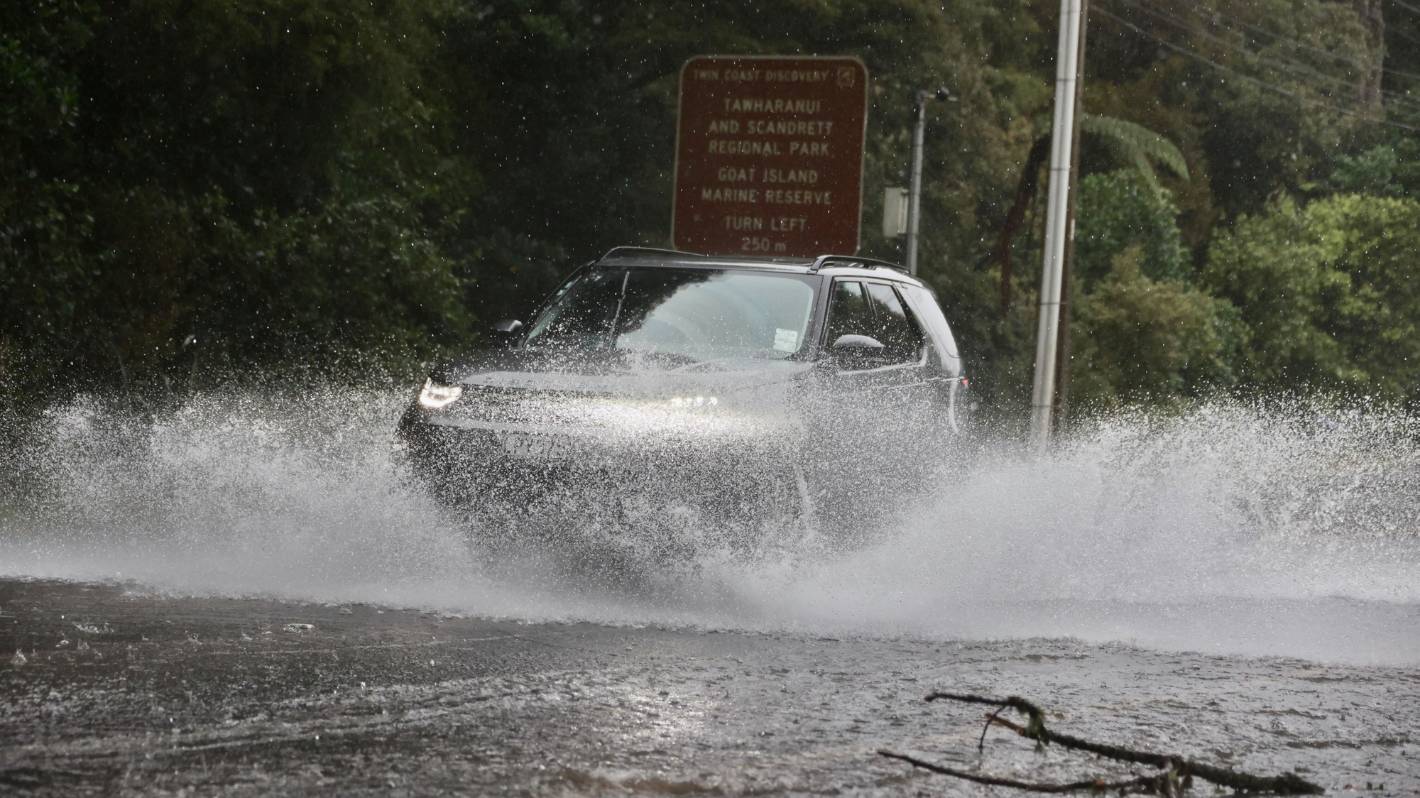
MetService has issued a severe weather watch warning ahead of Auckland Anniversary Weekend.
Whilst Taranaki residents are being urged to watch out for heavy rain from 2pm onwards on Friday, Aucklanders are being told to brace for strong winds from as early as 7am on Friday.
Heavy rain warnings are in force across Northland, Auckland, Coromandel Peninsula and western Bay of Plenty.
Meanwhile, a heavy rain watch is in place for Mount Taranaki, and a strong wind watch is in effect for Auckland.
The supercity can expect heavy rain and strong winds from early on Friday, as a foreboding weather system looms over Northland and Auckland from Thursday night.
It could mean 15 hours of heavy rain with possible thunderstorms, MetService said – from about 8pm on Thursday until at least Saturday morning,
Northland is due to get the weather first, and is bracing for a downpour later on Thursday, with Reserviced warning of severe rainfall in the evening.
It’s bad news for holidaymakers and concert goers, with Elton John scheduled to make his farewells to Aucklanders on Friday and Saturday night at Mt Smart stadium.
Auckland is also hosting the Auckland International Buskers Festival this weekend.
Organisers say they will take plans day by day and cancel shows when required, and already believe Friday’s torrential rain means the end for acts between 12 and 2pm. Later cancellations will be announced closer to the time.
Sunday brings the Gardens Music Festival, headlined by Fatboy Slim. It made headlines this month when organisers had to move from Victoria Park to the Auckland Domain because the park was too damaged for another festival.
Then on Monday is the highly anticipated Laneway Festival at Western Springs, which also moved venue from Albert Park in order to host a larger event.
There are also family friendly summer activities planned at Silo Park on Saturday and Sunday, including a giant rock climbing wall and rides shaped like animals.
Over four days is the Auckland Folk Festival in the Kūmeu Showgronds, who are full steam ahead rain, hail or shine.
Waka Kotahi is urging people to avoid getting suck in traffic jams as they get away for the long weekend, and to use the Holiday Journey Planner to avoid peak travel times in unsympathetic weather.
“If everyone leaves plenty of time for their journey, drives to the conditions and plans before leaving home, frustrations can be eased. We want everyone to arrive safely at their destination,” Liam Ryan, Waka Kotahi NZ Transport Agency Journey Manager said.
Whatever the weather, with 20,000 or so people expected at One Love Festival in Tauranga this weekend, and Festival One in Cambridge, drivers should expect heavier than usual traffic.
In the Coromandel, State Highway 25A will be closed overnight due to road repairs.
At 10am on Thursday, MetService added heavy rain warnings over the Coromandel Pensinsula from 10am Friday, and western Bay of Plenty from 4pm Friday, until Saturday January 28.
There are also heavy rain watches for northern parts of Auckland, which are also facing a strong wind watch, and Mt Taranaki.
Once the heavy rain eases, showers should be expected throughout the weekend.
The next update is due at 9pm on Thursday.
STUFF
Rivers bursting their banks, flash floods and more intense cyclones – how climate change is making floods more extreme.
The national forecaster has issued an orange heavy rain warning that extends from Cape Reinga to Topuni.
Between 100mm and 130mm of rain is expected in Te Tai Tokerau, especially in the east and north, with thunderstorms possible.
Peak rates of 10mm to 20mm per hour are expected during Friday morning and afternoon.
The warning period runs from 10pm Thursday to 10pm Friday, but MetService said showers will still be expected throughout the weekend.
The Kaeo River, which threatens to flood State Highway 10 in the wrong conditions, shows the awa was still far from spilling out on Thursday morning.
The rainy end to January is brought courtesy of a “subtropical low”, which may also rain heavily on Auckland and Coromandel Peninsula from Friday to Saturday, and western Bay of Plenty on Saturday.
MetService Meteorologist Dan Corrigan said the low has already developed as forecasted and is currently northwest of the top of Northland.
Ricky Wilson/Stuff
State Highway 1 north of Warkworth flooded during Cyclone Hale earlier this year. (File photo)
Throughout Thursday it will head closer to Aotearoa and by 10pm at least, those heavy rains will descend.
“More moderate rain is expected to develop earlier in the day starting in the Far North and moving south as the system move southwards,” he explained.
Corrigan said after a wet start to the year, this rain is likely to have a serious impact on the region.
Northland has already been hit by two heavy rain events so far in 2023: a storm on January 3 to 5 resulted in two people dying after hitting a downed tree.
The region was also drenched in a month’s worth of rain on January 10 from Cyclone Hale, causing widespread flooding and road closures.


