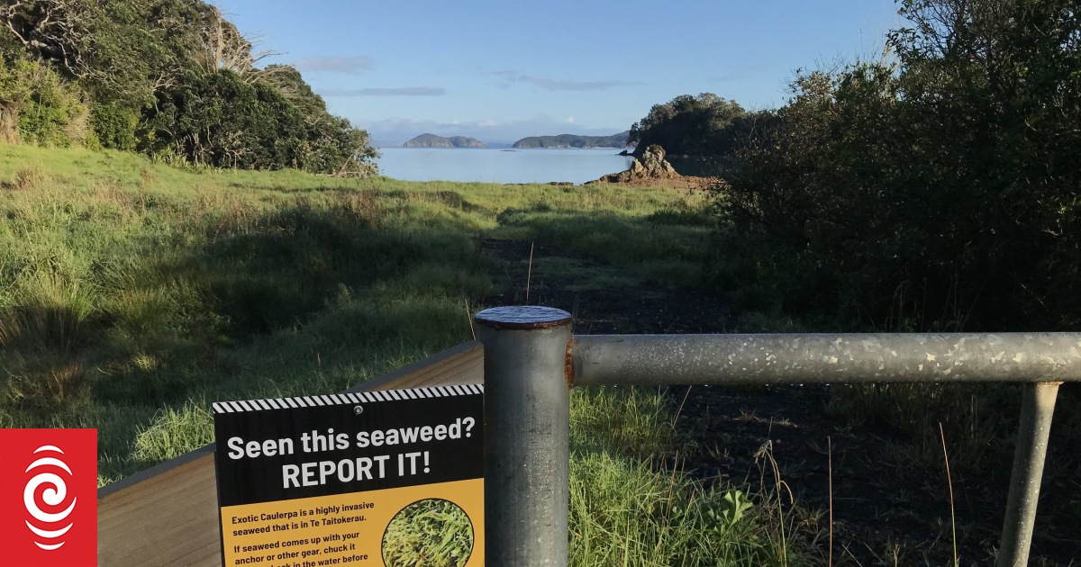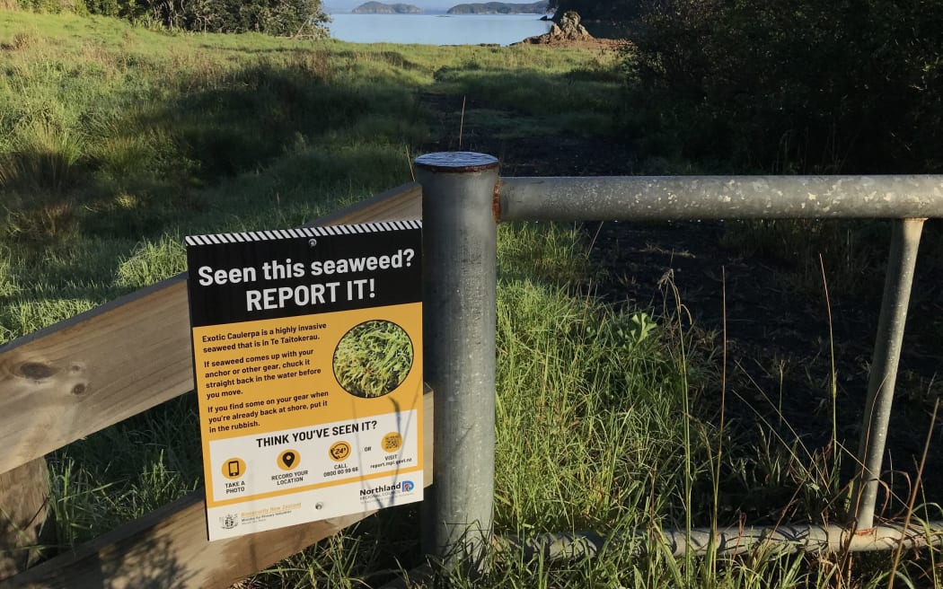
A new sign of the times at Omākiwi Cove, Bay of Islands.
Photo: LDR / Susan Botting
Boaties are from 12 June banned from anchoring across more than 1000 hectares of Bay of Islands moana, as the government and mana whenua move to fight the growing threat of one of the world’s most invasive marine seaweeds.
The government’s first mainland exotic caulerpa anchoring ban, known as a controlled area notice (CAN), starts from 11.59pm Monday night along with a mana whenua rāhui, from Monday morning.
Fishing of all sorts, diving and kaimoana gathering are also banned.
Biosecurity New Zealand deputy director-general Stuart Anderson said caulerpa, at differing densities, had been found across 200 hectares in the Bay of Islands.
That is up from 16 hectares identified as having caulerpa on 31 May. Exotic caulerpa was first found in Omākiwi Cove on 3 May.

NIWA and Northland Regional Council (NRC) have done more than 150 surveillance dives in the Bay of Islands to date.
“We are currently developing wider Northland surveillance with (NRC),” Anderson said.
Fragments of caulerpa moving around are a major caulerpa spread culprit. Anchoring is one of the major ways caulerpa is spread. A piece of caulerpa the size of a freckle can cover an area the size of a rugby field in the right conditions.
The caulerpa anchoring ban area is bounded by Whau Point in the south-east across the Albert Channel through to the south-eastern tip of Te Ao Island, then across to the eastern shoreline of Poroporo Island (near Urupukapuka Island) and then south-west towards the northern tip of Tokatokahau Point. It covers up to the high tide area.
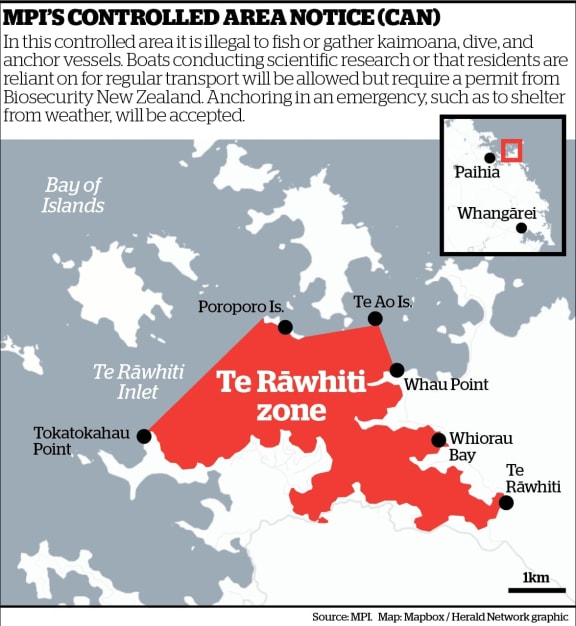
The government’s new caulerpa controlled area notice (CAN).
Photo: MPI / NZ Herald graphic
The new biosecurity-controlled zone’s specific co-ordinates can be found online.
“The CAN area has been designed to both reflect the science in terms of the continuing risk while at the same time ensuring the boundaries are easy to understand,” Anderson said.
Under the new CAN it was illegal to remove any marine organisms including fish, seaweed, crayfish or shellfish from the zone – meaning fishing for any species in the area was not allowed, Anderson said. This included spearfishing, crayfish, kina and other shellfish gathering, net fishing and drift fishing from any type of vessel.
No anchoring was allowed in the controlled area other than for a few permitted activities including scientific research or where residents were reliant on a vessel for regular transport. Biosecurity New Zealand permits would be needed for this. Emergency anchoring will be allowed in some situations such as to shelter from weather.
He said diving in the area was also banned.
Anderson said two species of exotic caulerpa had been found in the Omākiwi Cove area – caulerpa brachypus and Caulerpa parvifolia. The amount found suggested the seaweed had been in the area for a number of seasons.
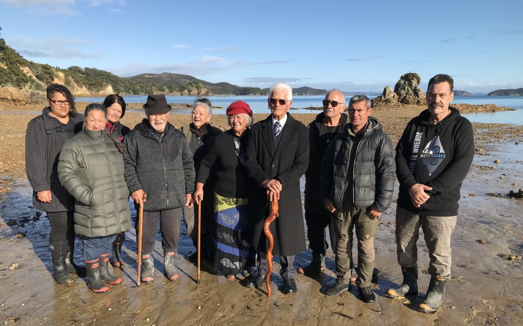
Mana whenua layed down a rāhui in fight against caulerpa on 12 June, at Bay of Islands.
Photo: LDR / Susan Botting
Patukeha and Ngāti Kuta hapū have declared a rāhui over the same area as the government’s CAN, preventing boat anchoring, fishing, kaimoana harvesting and diving.
The hapū are working with the Ministry for Primary Industries (MPI)’s Biosecurity New Zealand and NRC after the discovery of a substantial quantity of exotic caulerpa.
The rāhui ceremony was led by Patukeha and Ngāti Kuta hapū at Omākiwi beach on Monday morning.
Kaumatua Hone Martin, who led the rahui ceremony, said the community fight would be a challenging one against caulerpa, te ngārara o te moana – or the maggot of the sea.
Hapū spokesperson Viki Heta said mana whenua and the partners were working together to formalise a response plan to the biosecurity threat.
The rāhui was one of several methods to be applied to the affected area to reduce the risk of spreading caulerpa to the rest of the Bay of Islands.
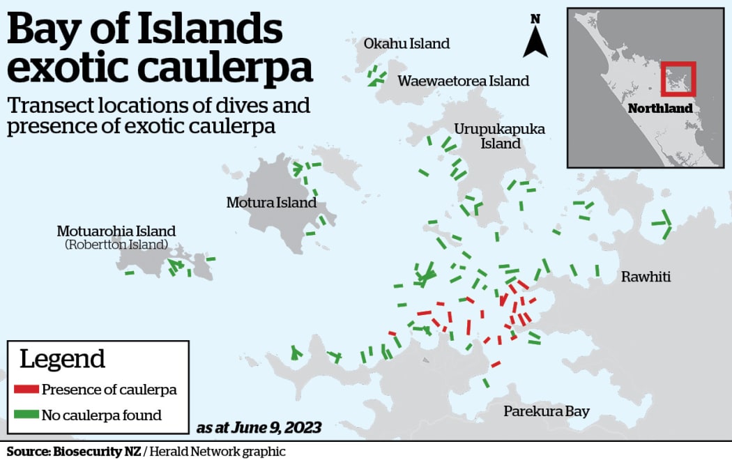
Map showing the more than 100 Bay of Islands spots checked for caulerpa until June 9. Areas where caulerpa is present show in red.
Photo: MPI / NZ Herald graphic
The rāhui was a traditional Māori method applied to manage activities and would work in synergy with the CAN applied by MPI, she said.
“There is a lot at stake here and exotic caulerpa has potential to devastate shellfish beds and fish habitats. If this happens, there will be no kaimoana for future generations.
“We must work collaboratively – hapū, government, community and businesses – to take control of this threat. It will require cooperation and organisation.”
Heta said the rāhui would stay in place indefinitely, until the risk of caulerpa spread had been eliminated.
“We are calling everyone to participate in upholding the rāhui and the controlled area notice restrictions to ensure we are united in our efforts to stop the spread of this pest seaweed,” Heta said.
If you see or suspect caulerpa, report it through 0800 80 99 66 or by completing the online reporting form.
Full information about exotic caulerpa and the new legal controls is available on MPI’s website.
Local Democracy Reporting is Public Interest Journalism funded through NZ On Air

