
Northland Regional Council/Supplied
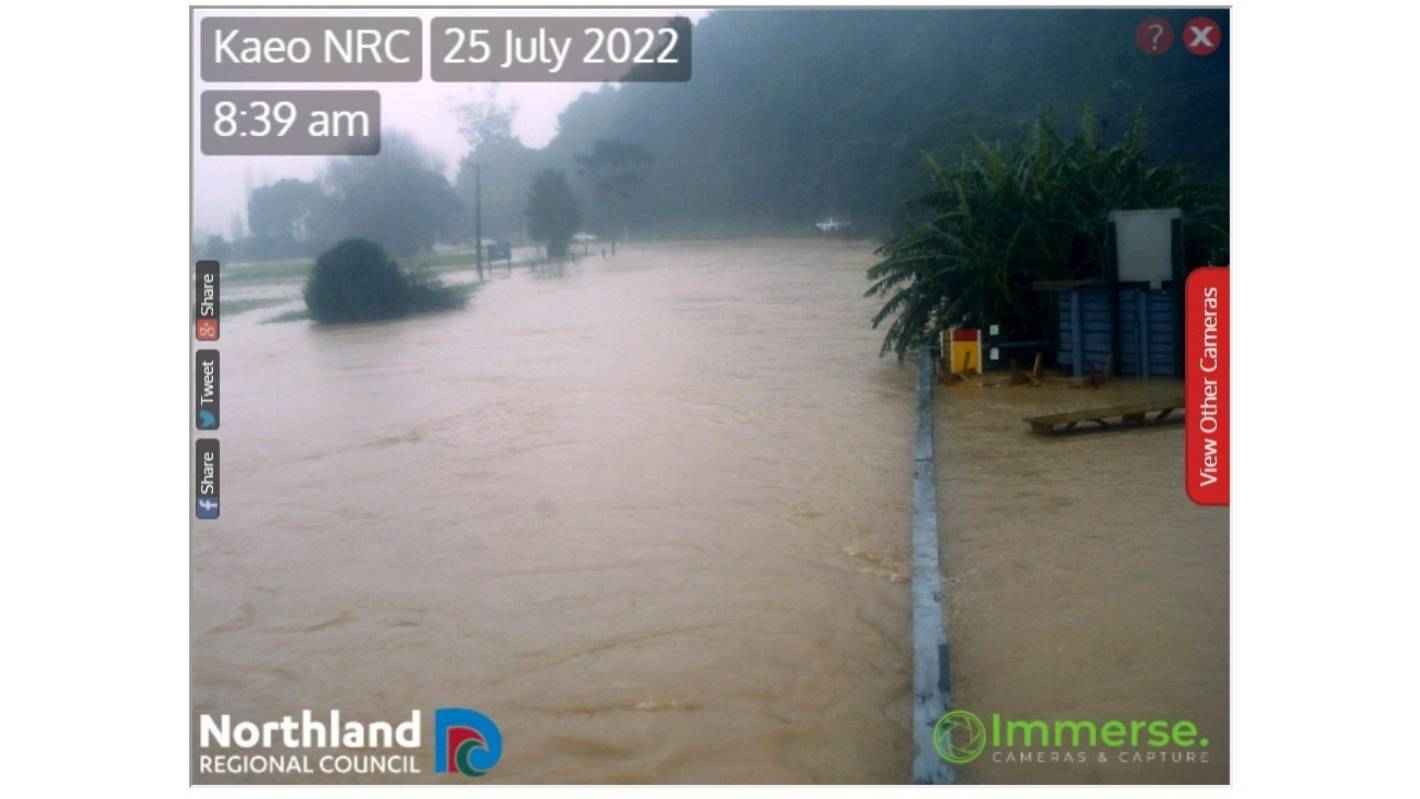
The Northland Regional Council webcam shows the river near Kaeo has burst its banks.
- Strong winds are lashing the top of the North Island, with gusts of about 100kph.
- The speed limit on Auckland’s Harbour Bridge has been lowered and ferry services cancelled due to the weather.
- In Northland, a river has burst its banks and eight roads are closed.
- Wind and rain warnings and watches are in place for much of the North Island.
- The bad weather is expected to continue throughout the week.
Heavy rain and strong winds hitting Northland and Auckland are expected to continue throughout the day as a low pressure system travels down the country.
MetService meteorologist John Law said that strong winds are expected to peak during the day and continue overnight in Auckland.
“We’ve already seen gusts of wind in exposed areas of about 100kph, and it’s been pretty windy through the night time in those exposed areas,” said Law.
READ MORE:
* Heavy rain, gales to hit upper North Island ahead of wet week for many
* Hotter than Hades: What to do when climate change catches up with the unwary
* Northland to bear brunt of heavy rain, poor weather, set to hit top of country
The low pressure system is currently sitting to the northwest is expected to continue moving down the country throughout the week bringing with it more wet and windy weather.
Abigail Dougherty/Stuff
Wind whips up the water at Auckland’s port.
“It’s one to keep an eye on as we head into tomorrow for places like Canterbury and the South Island, as easterly winds push rainfall back onto those areas.”
MetService had issued a number of weather watches and warnings across much of the upper half of the North Island.
Heavy rain warnings are in place for Northland, Auckland from Whangaparaoa northwards, the Coromandel Peninsula and the western Bay of Plenty until Tuesday, with up to 120-160mm of rain expected in places.
In Auckland south of Whangaparaoa, MetService has issued a heavy rain watch until Tuesday afternoon.
HOMED
The wild weather is coming… are you ready? Here’s how to check.
Tasman and Marlborough will also see heavy rain at the start of the week, between Monday afternoon and midday Tuesday.
There are warnings about strong wind and gusts for Northland, Auckland, Bay of Plenty, Coromandel Peninsula, Eastern Waikato and Buller in the South Island.
In Auckland on Monday, MetService said rain with heavy falls was expected with strong northeasterlies that could gust up to 110kph.
The speed limit had been reduced on the harbour bridge on Monday morning, and Auckland motorists should expect possible closures over the bridge due to high winds, Waka Kotahi NZTA said.
“Caution is advised, especially for high-sided vehicles and motorcyclists,” the website said.
Closures may occur on the bridge if severe winds gust over 90kph.
All Gulf Harbour ferry services had been replaced by buses and shuttles due to the weather, Auckland Transport said.
Some West Harbour ferry services had also been cancelled.
In Northland, it was expected gusts could get up to 120kph on Monday.
Abigail Dougherty/Stuff
Aucklanders faced a wet and windy start to the working week.
Power outages and traffic delays may be on the way, Whangārei District Council warned.
Commuters should watch out for flooding, road slips, and fallen trees.
At least eight roads were obstructed in Whangārei and the council was asking travellers to take care.
The Northland Regional Council webcam showed the river near Kaeo had burst its banks, likely closing the road.
The largest amount of rainfall would likely be from Northland down to East Cape, with Mount Taranaki, western Tasman and Marlborough also likely to see heavy rainfall.
Rain should ease to showers later in the week for Auckland and Northland, with next weekend shaping up to be fine apart from a few showers further North.
As the low drives southward, rainfall may reach warning criteria in parts of the South Island later this week.
MetService advised people to stay up to date with weather watches and warnings in their area.
Christchurch should expect a week of rain followed by a dry weekend. Heavy rain watches and warnings may be issued for Canterbury later in the week.


